Aerial Photography Services
While the technology just keeps getting better, aerial photography and videography services cost no more to your project than on-the-ground services. Show your projects in a wider context.
We’re licensed by the FAA for commercial drone operation (Part 107).
Aerial Photography and Videography
Adding aerial photography and videography to your project doesn’t add cost. But it does give your clients and community a view of the wider context of your project.
Aerial photography and videography is geo-tagged for location and elevation, to pinpoint exactly where the pictures are being taken.
We can also deliver 360º aerial images and videography, should your project call for it.
“Time-Lapse” Aerial Photography
We can pre-program a flight line and then store it in our drone’s memory. Later, as your project progresses, we can fly the exact same flight line, capturing a perfect “before and after” story for your image library, progress photography requirements or marketing deliverables. This works for videography, as well (called hyperlapse videography).
Licensed, Certified and Insured.
Don’t just hire any “drone cowboy” to take your overheads. We hold the mandatory FAA license for commercial drone operation (Part 107). All our drones are registered with the FAA, and we hold insurance specific to drone operation.
Latest Projects
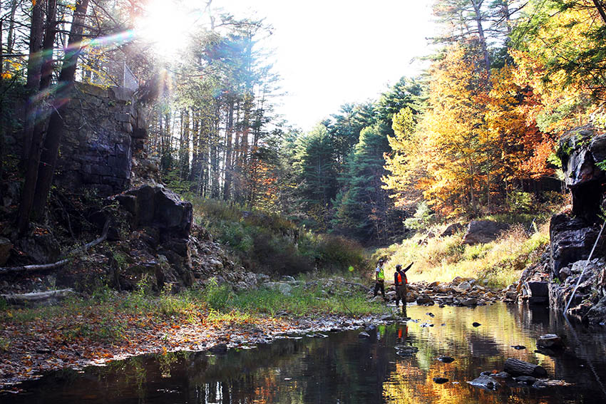
Upper Roberts Meadow Dam Removal
The Commonwealth’s largest dam removal project left behind a frisky river in a sunlit valley.
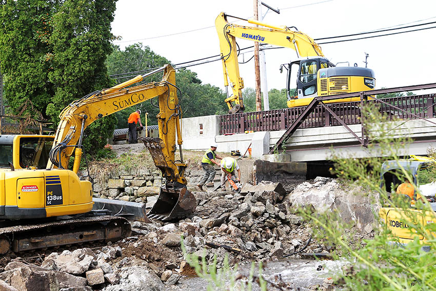
Jones River Restoration
A dam removal, at an old historic millpond, lets the Jones River flow freely through Kingston, Massachusetts.
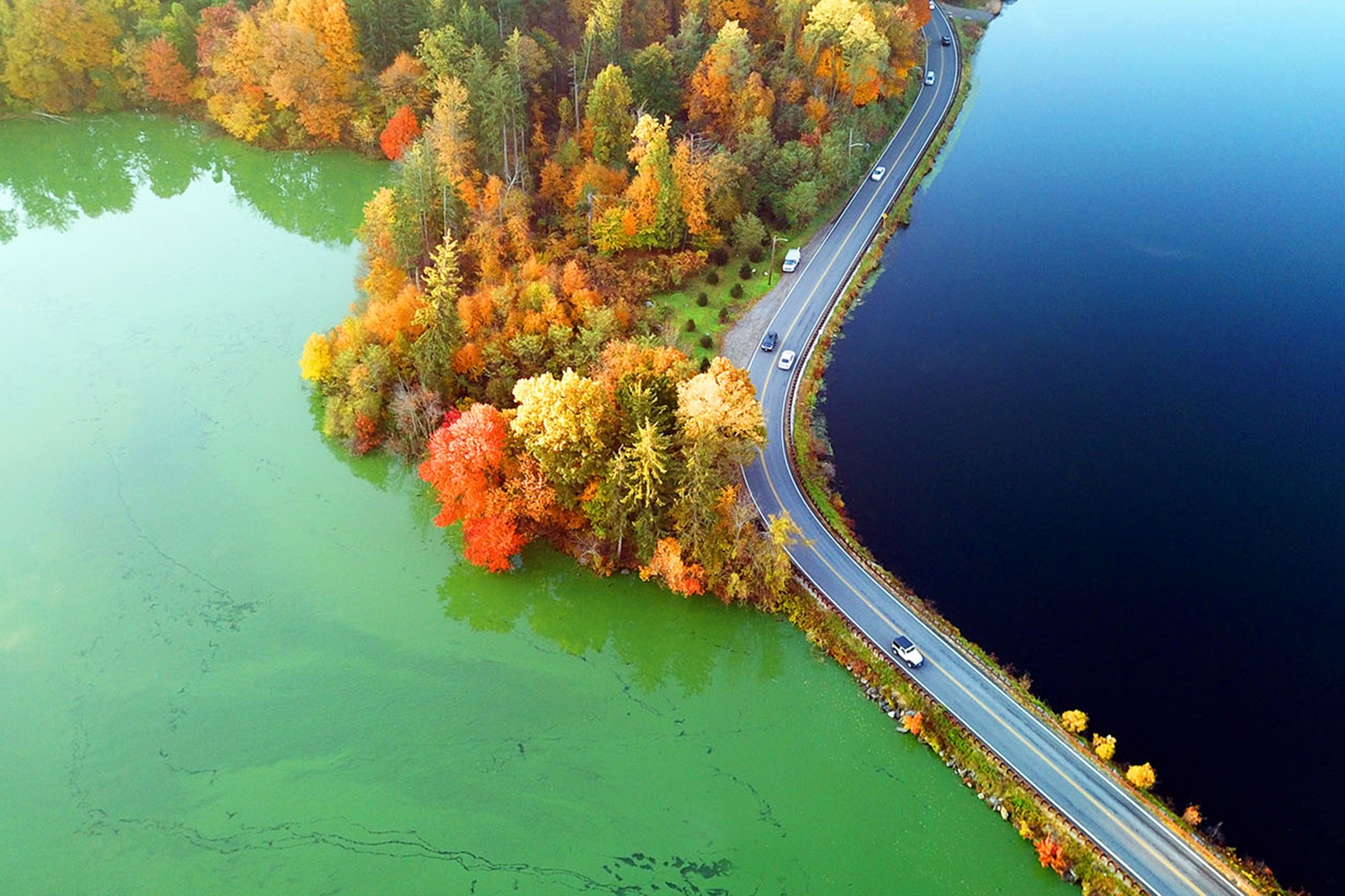
Algae Survey
One lake received the pond dye, and the other — just opposite the causeway — didn’t. Guess which is which.